About This Weather Alerts Map
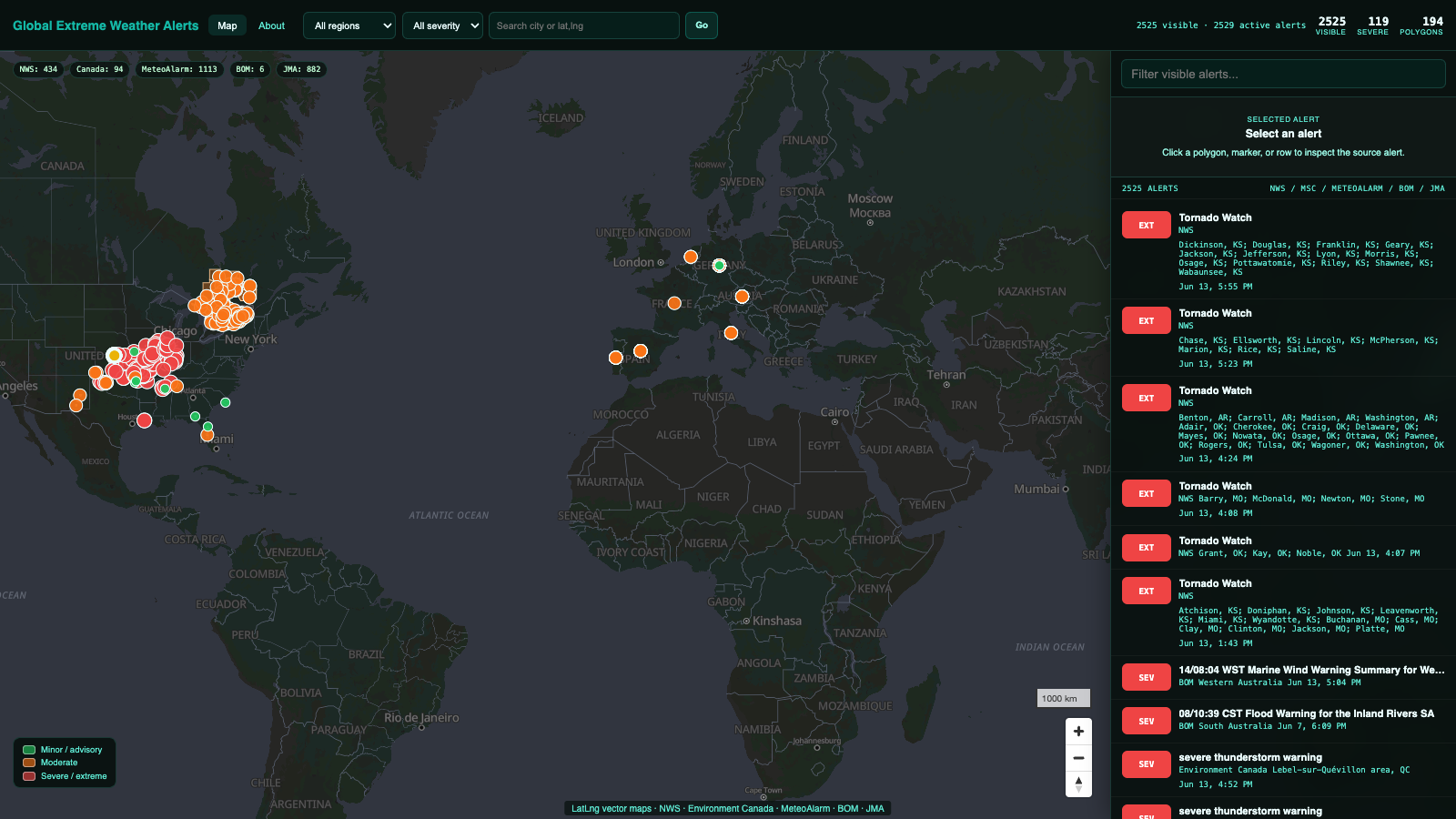
The LatLng extreme weather map combines multiple official public alert feeds into a single view. The live dashboard includes region and severity filters, map navigation, searchable visible alerts, and direct links back to source alerts when available.
The map is intended as a public visualization and educational resource. It is useful for showing where severe weather warnings are active, but it should not replace local emergency alerts, official weather agencies, or life-safety notification systems.
Data Sources
| Region | Source |
|---|---|
| United States | National Weather Service active alerts API. |
| Canada | Environment Canada / MSC GeoMet weather-alerts feed. |
| Europe | MeteoAlarm country alert feeds. |
| Australia | Bureau of Meteorology warning products when available from the edge. |
| Japan | Japan Meteorological Agency warning data and area metadata. |